Last updated 30.8.2026
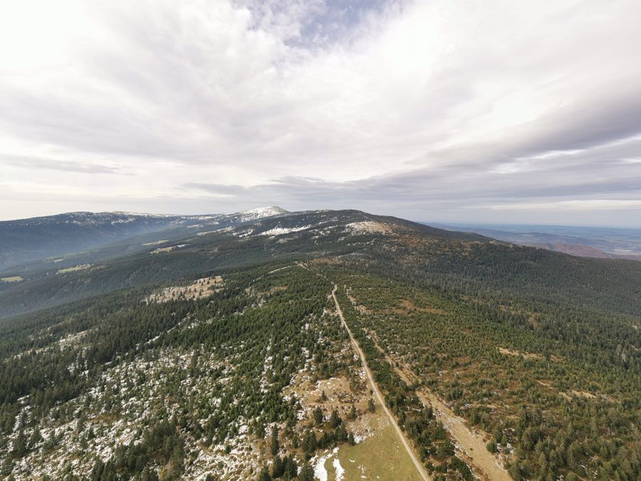
The Ore Mountains in the Czech Republic are the range most people drive past on their way somewhere else. They run for roughly 130 kilometres along the north-western edge of the country and form a natural border with the German state of Saxony, which is why they carry two names: Krušné hory on the Czech side, Erzgebirge on the German one. There are no granite spires here and no glaciers. What there is instead: rounded ridges that hold snow longer than almost anywhere else in Czechia, a UNESCO-listed mining landscape you can walk into, boardwalks across raised peat bogs, and the highest town in Central Europe.
This guide gives you twenty-one concrete destinations, from Klínovec and Boží Dar through the silver and tin mines to reservoirs, ridge walks and corners the coaches never reach. Every tip comes with a real route, its length and its elevation gain, measured on the actual path from contour data rather than guessed. You will also find the parking situation, ticket prices in Czech crowns with a rough sterling equivalent, and honest warnings: where the wind bites, where a pushchair will not go, and where you have to book ahead.
The Ore Mountains at a glance
- Where: north-west Czech Republic, along the border with Saxony. Nearest airports: Prague (about 2 to 2.5 hours by car), Dresden (about 1.5 hours), Karlovy Vary for the western end.
- Highest point: Klínovec (1244 m) with a stone lookout tower, entry roughly 50 CZK (about £1.70).
- For families: Boží Dar, the Boží Dar peat bog boardwalk, the Ježíškova cesta trail, Plešivec with its rope park.
- For history: the UNESCO mining landscape, Jáchymov (Adit No. 1), the Mauritius mine, the Johannes adit, Mědník hill.
- For quiet: Lesná, Měděnec, Jelení hora, the Fláje and Přísečnice reservoirs.
- Winter: downhill skiing at Klínovec and Boží Dar, cross-country on the Krušnohorská magistrála trail network.
- When to go: summer for walking and the mines, winter for skis. The range works all year round.
Where the Ore Mountains are and how to get there
Picture the Czech Republic as a rough diamond. The Ore Mountains form its top-left edge, a long ridge separating Bohemia from Saxony. On the Czech side the land drops away steeply into the industrial basin around Most and Chomutov. On the German side it slopes gently down towards Chemnitz and Dresden. That asymmetry explains a lot: the steepest climbs in this article all start on the Czech slope, while the ridge itself is wide, boggy and surprisingly flat once you are up there.
By air. Prague is the obvious gateway, with the western end of the range roughly 150 km away, about 2 to 2.5 hours by car via Karlovy Vary. Dresden airport sits even closer to the eastern ridge, about an hour and a half from the border crossings at Cínovec or Moldava. Karlovy Vary has a small airport with a thin, seasonal schedule, so check what is actually flying before you count on it.
By car. This is the honest answer for a trip built around several stops. From Prague you reach Boží Dar in about 2 to 2.5 hours through Karlovy Vary. The eastern Ore Mountains, meaning Krupka and Litvínov, take a similar time via Teplice. Roads on the ridge are well kept and rarely busy outside the ski season.
By train and bus. Perfectly possible, just slower. Trains from Prague run to Karlovy Vary, Chomutov and Teplice, and regional buses climb from there to Boží Dar, Jáchymov and the ridge villages. Dresden is linked to the Czech side through Bad Schandau and Děčín. Without a car you will spend more time planning and have less freedom to string several tips together in a day, so pick one base and radiate out from it.
When to go. Summer and early autumn, June to October, are the season for walking, lookout towers and mine tours. Most of the underground tours run roughly from May to September only. Winter belongs to skiing and cross-country: the ridges hold snow well and the Krušnohorská magistrála runs for hundreds of kilometres of groomed track. Spring and late autumn are the quietest months by far, but expect mud on unsurfaced paths and a good share of attractions shut.
💡 Tip: Parking in Boží Dar is paid, roughly 100 CZK for three hours (about £3.50) or 200 CZK for the whole day (about £7). If you are planning several trips from one base, it pays to stay in the town itself and leave the car where it is. Find places to stay in Boží Dar and around →
21 trips and hikes in the Ore Mountains
They are ordered roughly west to east, and within that from the best known to the ones you will have to yourself. Choose by what you are after: summits and views, underground, or quiet water. Each tip lists a specific route with its distance and elevation gain, measured on the real path from contour data. All figures are metric, as they are on Czech trail signs and maps.
1. Klínovec (1244 m), the roof of the Ore Mountains
The highest peak in the range and the logical first stop. A stone lookout tower stands on the summit, and on a clear day you can see across Bohemia as far as the Šumava range on the Austrian border, and the other way to Fichtelberg, the highest mountain in Saxony. Entry to the tower costs about 50 CZK (around £1.70) and it usually opens 9:00 to 17:00, longer in summer. You can walk up from Boží Dar in an hour (about 3.9 km) or take the chairlift. In summer Trailpark Klínovec adds four downhill mountain bike trails, among the best in the country.
Route: Boží Dar (1028 m) → Klínovec (1244 m) on the waymarked path and back the same way
Distance: 7.8 km · Elevation gain: 232 m · Difficulty: moderate
about 2.5 hours of walking; chairlifts also run up from Jáchymov and from Loučná
2. Boží Dar, the highest town in Central Europe
At 1028 m, Boží Dar is the highest town in Central Europe and the best base for the whole western half of the range. It has the Ježíškova pošta, a post office where Czech children send their letters to Ježíšek, the Baby Jesus who brings presents at Christmas here instead of Father Christmas. There are restaurants, hire shops and the small Novako ski area. The name translates as “God’s gift”, which is what the sixteenth century silver miners called the place. Everything else on this list is within easy reach.
Route: circuit from Boží Dar to Božídarský Špičák (1116 m) and back
Distance: 8.3 km · Elevation gain: 141 m · Difficulty: easy
flat going between peat bogs, only the final pull onto Špičák climbs; the town itself sits at 1028 m, so you start high and stay there
💡 Tip: The Ježíškova cesta, or Baby Jesus Trail, starts in Boží Dar. It is an interpretive family route in two versions, a shorter loop of about 5.5 km and a longer one of nearly 13 km. The short version works with a pushchair.
3. Božídarské rašeliniště, a boardwalk across the peat bog
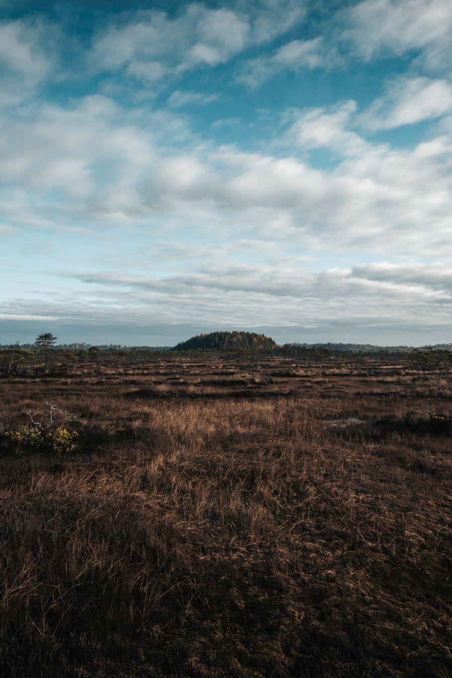
One of the loveliest easy walks in the Ore Mountains. The interpretive trail, roughly 3.2 to 3.4 km long, runs on a wooden boardwalk straight through a national nature reserve, with twelve information boards along the way. It is flat, made for families and passable with a pushchair for most of its length. Entry is free. Come in the late afternoon light, when the bog goes quiet and the cotton grass catches the sun.
Route: boardwalk circuit through the Božídarské rašeliniště bog from Boží Dar
Distance: 3.1 km · Elevation gain: 16 m · Difficulty: easy
the flattest route in the whole range, staying between 974 and 994 m; the trail signs say 3.2–3.4 km, the measured loop is a few dozen metres shorter; mostly pushchair friendly
4. Jáchymov, silver thalers, radon spa and the UNESCO mines
A mining town with an extraordinary CV. Silver thalers were struck here in the 1500s, and the word “dollar” comes from that coin by way of German Taler. Later the town opened the world’s first radon spa, built on the radioactive water that seeps out of the old workings. The Svornost mine is among the longest working mines in Central Europe and still pumps radon water up for the spa, though as an operating mine it is not open to casual visitors. Adit No. 1 is: roughly 250 metres of original tunnel on a guided tour, paid, and a proper trip underground. History travellers should also look at the Royal Mint, now a museum, and the Jáchymovské peklo trail, about 8.5 km, which traces the uranium labour camps where political prisoners were held under communism.
Route: Jáchymov, main square (652 m) → Adit No. 1 (767 m) and back
Distance: 4.0 km · Elevation gain: 118 m · Difficulty: easy
the town itself is steep in places; the Jáchymovské peklo interpretive trail measures 8.5 km
5. Měděnec and Mědník hill, a mountain riddled with adits
Mědník hill (910 m) above the village of Měděnec is drilled through with old tunnels. In the summer season you can book a tour of the Marie Pomocná adit, about an hour underground at around 6 °C, so bring a jacket even in August. A small chapel stands on top, and a short way off are the Sfingy u Měděnce rock formations with a good view over the central ridge. This is the quiet middle of the Ore Mountains, where the crowds simply do not come.
Route: Měděnec (844 m) → Mědník hill (910 m) → Sfingy rocks → back to the village
Distance: 2.8 km · Elevation gain: 93 m · Difficulty: easy
the shortest summit on this list, done in an hour
6. Loučná pod Klínovcem and the view to Fichtelberg
A mountain village directly below Klínovec, close enough to the border that Fichtelberg (1215 m), the highest mountain in Saxony, feels like it is in the next field. In winter this is ski country, in summer a starting point for ridge walks. From Loučná you can walk to the abandoned settlement of Königsmühle, a handful of ruined houses in the forest that tell the story of the post-war expulsion of the German-speaking population, which emptied villages all along this border. It lies roughly 2 km south-east of Loučná and you drop down to it on a short path of about 1.5 km through the valley, an easy there-and-back, though the final gully gets slippery in the wet.
Route: Loučná pod Klínovcem (865 m) → the abandoned settlement of Königsmühle and back
Distance: 5.2 km · Elevation gain: 210 m · Difficulty: easy
you descend into the valley and come back up the same slope, so the climbing all happens on the way home; the final gully gets slippery in the wet
7. Komáří vížka and the longest chairlift in Czechia
At the eastern end of the range, above the town of Krupka, you can ride up to Komáří vížka (807 m) on the longest single-section chairlift in the Czech Republic. It runs for over 2.3 km and the ride takes about a quarter of an hour. An adult single costs roughly 170 CZK (around £6), a return about 240 CZK (around £8), with children cheaper. At the top there is a lookout, a restaurant and a view down over the České středohoří, a scatter of volcanic cones on the plain below. It combines well with the “In the footsteps of the miners” trail from Krupka, which passes the Starý Martin adit, open to visitors.
Route: lower chairlift station in Krupka (332 m) → Komáří vížka (807 m) on foot and back
Distance: 7.4 km · Elevation gain: 507 m · Difficulty: demanding
the steepest climb in this article; 507 m is the total of all climbing there and back, the net height difference is 475 m. The chairlift covers 2.3 km and lifts you 465 m, so walking one way and riding the other is the sensible plan
💡 Tip: The chairlift runs seasonally and depends on the weather, so check the operating hours before you drive over rather than standing underneath it wondering. Cyclists can send a bike up too.
8. Hřebečná and the Mauritius mine, the great tin working
The former mining hamlet of Hřebečná hides the Mauritius mine, the most famous tin mine in the Ore Mountains, worked from the sixteenth century onwards. Tours run roughly from May to September and booking is compulsory. It is around 6 °C inside, so pack something warm. Next door is the Johannes adit, also sixteenth century, with vast underground chambers, and again you need to reserve ahead. Both belong to the UNESCO mining landscape.
Route: Abertamy (894 m) → Hřebečná and the Mauritius mine (960 m) and back
Distance: 5.6 km · Elevation gain: 142 m · Difficulty: easy
the tour itself then adds stairs and low passages, and it is around 6 °C down there
9. Blatenský vrch and the Vlčí jámy sinkholes
Above the small town of Horní Blatná, Blatenský vrch (1043 m) carries one of the oldest lookout towers in the range, built in 1913, with a small token entry fee. Below it lie the Vlčí jámy, literally the wolf pits, collapsed hollows left by centuries of tin mining and now safely accessible. Moss, birch and vertical rock walls make this one of the most photogenic corners of the western ridge. The two combine into a short easy loop, with a pushchair possible on the surfaced sections.
Route: Horní Blatná (894 m) → Vlčí jámy → Blatenský vrch (1043 m) → back
Distance: 3.2 km · Elevation gain: 153 m · Difficulty: easy
a short loop with a single continuous climb up to the tower
10. Lesná, a quiet village with a folk house and viewpoints
A tip for anyone who wants nobody around. Lesná, in the eastern Ore Mountains, has been overlooked for years. It has the Krušnohorský lidový dům, a reconstructed Ore Mountains folk house furnished in period style with a voluntary donation at the door, an education centre with a children’s playground, a geopark and an arboretum, all freely accessible, plus short walks out to the Medvědí and Eduardova rocks with views over the ridge. There are surprisingly few people about.
Route: Lesná (891 m) → Eduardova skála (910 m) → Medvědí skála (924 m) → back
Distance: 9.0 km · Elevation gain: 134 m · Difficulty: moderate
long but almost flat; for a shorter version, walk out to just one of the rocks
11. Klíny, adrenaline and views over the valley
The Klíny resort in the eastern half is a ski area in winter and an outdoor centre in summer. The chairlift runs roughly from May to October, daily in July and August, and will carry your bike up to Klíny bike park, where the trails run from green and blue family lines through red to black for experienced riders. The biggest thrill is the zipline, a flight of about 1.4 km over the Šumenské valley, and there is also a bobsleigh track, a rope park and viewpoints above the Flájský potok valley. A good call if you are travelling with teenagers who want to move and be slightly frightened. Check current fares on the resort’s own website.
Route: Klíny (777 m) → the floor of the Šumenské valley and back up
Distance: 3.8 km · Elevation gain: 112 m · Difficulty: easy
on foot; the bike park, the zipline (1.4 km) and the bobsleigh track are separate paid attractions and have nothing to do with this route
12. Fláje reservoir and its buttress dam
The Fláje reservoir is the only dam in the Czech Republic built as a hollow buttress structure rather than a solid wall, which makes it a genuine engineering oddity: from the downstream side you look at a row of concrete columns holding back the water. There is free parking by the information centre and tours of the dam can be arranged by appointment. Just above the reservoir, the Puklá skála viewpoint looks down over the surface. The surroundings are made for gentle walking, and for cross-country skiing in winter.
Route: car park by the Fláje dam → Puklá skála viewpoint and back
Distance: 3.0 km · Elevation gain: 79 m · Difficulty: easy
a surfaced path above the water with one gentle climb to the viewpoint
13. Přísečnice reservoir and Jelení hora
The quiet Přísečnice reservoir near Chomutov supplies drinking water, which means no swimming, but the shoreline walks and the views make up for it. There is a darker story under the surface: a whole town of the same name was demolished in the 1970s to make room for the water. From the reservoir you climb Jelení hora (993 m), a nephelinite hill with a wide panorama over the central ridge. The last stretch is steeper and slippery when wet, so wear proper boots.
Route: Kryštofovy Hamry (682 m) → Jelení hora (993 m) and back
Distance: 7.3 km · Elevation gain: 317 m · Difficulty: moderate
the final part of the climb is steeper and slippery in the wet, so bring proper boots
14. Cínovec, peat bogs and a swim in the mountains
Cínovec sits right on the German border on the main road from Teplice into Saxony, so it is easy to reach by car and is the obvious first or last stop if you are driving in from Dresden. It is the easternmost ski area in the range and the gateway to the Cínovec peat bog. Park at the Cínovecká slať junction on the border itself. An interpretive trail runs through, about 14 km in full, though you can walk just the short section to the bog, and immediately across the border it links to the German Georgenfelder Hochmoor with its own boardwalk. In summer you can swim in Dlouhý rybník, a natural lake in the middle of the peat landscape. Combine it with Moldava and the Fláje dam for a full day in the eastern Ore Mountains.
Route: Cínovecká slať → Georgenfelder Hochmoor → Dlouhý rybník → back
Distance: 7.8 km · Elevation gain: 76 m · Difficulty: easy
the whole route stays between 813 and 884 m, so it is a long walk rather than a climb
15. Plešivec, a lookout tower, a legend trail and a rope park
Plešivec (1028 m) above Abertamy is the family favourite of the western ridge, an easy thousand-metre summit with plenty at the top. There is a rope park with a giant swing, a playground and downhill trails, and the Stezka krušnohorských pověstí, a trail of Ore Mountains legends lined with carved wooden figures and a viewpoint at Švýcárna. The summit has a lookout tower and a restaurant. The chairlift and the rope park are paid, the legend trail is free.
Route: Abertamy (894 m) → Plešivec (1028 m) and back
Distance: 5.4 km · Elevation gain: 254 m · Difficulty: moderate
a steady climb through forest; a chairlift also runs up from the rope park
16. Rotavské varhany, basalt organ pipes in the forest
A natural monument near the town of Rotava: basalt columns that cooled into regular five and six sided shafts, standing side by side like the pipes of a church organ, which is exactly what the Czech name means. It is a short, easy walk, roughly 2 km and half an hour, and you can ride it on a bike. Nearby, the flooded Kernberg basalt quarry holds startlingly clear water.
Route: Rotava → Rotavské varhany and back
Distance: 4.0 km · Elevation gain: 84 m · Difficulty: easy
about 2 km each way, easy on a bike too
17. Pajndl lookout tower on Tisovský vrch
Above the town of Nejdek in the western Ore Mountains rises Tisovský vrch (977 m), known by its German name Pajndl. A solid stone lookout tower from the end of the nineteenth century stands on top, built between 1895 and 1897 and about 24 m tall. In clear weather you can pick out Klínovec, Fichtelberg across the border in Germany, and the distant summits of the Šumava. The climb through the forest is short and only the last part is steep. Think of it as the quieter alternative to a busy Klínovec.
Route: Nejdek (562 m) → Tisovský vrch with the Pajndl lookout tower (977 m) and back
Distance: 8.8 km · Elevation gain: 418 m · Difficulty: demanding
after Komáří vížka the second hardest route in this article: 400 metres of ascent is not a stroll, allow around three hours
18. The Anton Günther Trail, a ridge walk from Horní Blatná to Boží Dar
If you want to walk the Ore Mountains along the ridge under your own steam, take the Anton Günther Trail. It is named after the folk singer and songwriter from Boží Dar whose songs became the unofficial soundtrack of this region on both sides of the border. The trail links Horní Blatná with Boží Dar and runs roughly 16 to 17 km past the best of the western ridge: Blatenský vrch, the Vlčí jámy, peat bogs and lookout towers. A longer cross-border version along the whole ridge measures about 65 km.
💡 Tip: You can split the trail into stages. Both Horní Blatná and Boží Dar are served by public transport, so you do not have to walk back for the car.
Route: Horní Blatná (894 m) → Vlčí jámy → Blatenský vrch (1043 m) → Ryžovna → Boží Dar (1028 m)
Distance: 16 to 17 km per the waymarking · Elevation gain: 213 m on the measured line (13.5 km) · Difficulty: moderate
a long but gentle ridge walk, hard for its length rather than its climbing; Blatenský vrch is the high point
19. The Moldava mountain railway, a trip by historic train
One of the engineering treasures of the range is best enjoyed through a carriage window. The Moldava mountain railway connects the city of Most with the border village of Moldava and is protected as a cultural monument. The single-track line runs roughly 26.6 km, climbing into the mountains over about 557 metres of ascent, from 225 m at Most to 782 m at Moldava, past viaducts and long panoramic sections. Pair the ride with Cínovec or the Fláje dam. Check timetables and any seasonal excursion services before you go, as services thin out sharply outside the main season.
Route: by train from Most to Moldava; on foot you can continue Moldava → Cínovec
Distance: 26.6 km by train / 10.2 km on foot · Elevation gain: the line climbs 557 m (Most 225 m to Moldava 782 m) / 289 m on the walking section · Difficulty: easy
zero effort on the train; the walk on from Moldava to Cínovec is a relaxed ridge route
20. Loket Castle, the gateway to the western Ore Mountains
Just beyond the western foot of the range, already inside the Slavkovský les protected area, one of the most picturesque castles in the country sits on a granite spur inside a loop of the river Ohře. The name Loket means “elbow”, after the bend in the river. Loket Castle is open all year, every day. Admission without a guide costs an adult around 145 CZK (roughly £5), with a guided tour about 175 CZK (roughly £6), and children under six go free. A small historic town huddles below the walls and pleasant riverside paths run out from it. It makes an ideal stop on the way from Karlovy Vary up into the mountains.
Route: Loket (426 m) → Svatošské skály along the Ohře
Distance: 5.5 km one way · Elevation gain: 66 m · Difficulty: easy
flat going along the river, with a boat or train back; the castle itself is all stairs
21. Meandry Teplé, river bends in the foothills
One more for anyone who likes quiet water. The Meandry Teplé natural monument lies south of Karlovy Vary, inside the Slavkovský les protected area, where the river Teplá cuts into a canyon-like valley and loops back on itself under wooded slopes. It is an easy walk beside the water and pairs neatly with a day in Karlovy Vary, the spa town that acts as the gateway to the western Ore Mountains.
Route: Karlovy Vary-Doubí → Březová through the Teplá valley
Distance: 5.3 km one way · Elevation gain: 179 m · Difficulty: easy
along the water, with only a gentle climb towards the end
The UNESCO mining landscape and the mines you can enter
Since 2019 the Erzgebirge/Krušnohoří Mining Region has been inscribed on the UNESCO World Heritage List. It is not a single monument but a network of sites on both the Czech and the Saxon side, documenting some 800 years of mining silver, tin, cobalt and, in the twentieth century, uranium. Understanding that history changes how the whole range looks: the terraced hillsides, the water channels running along contours, the sudden hollows in the forest and the oversized churches in tiny villages all come from ore. If the underground appeals, work through it in this order:
- Adit No. 1, Jáchymov: the most accessible introduction, roughly 250 m of tunnel on a guided tour.
- Mauritius mine (Hřebečná) and the Johannes adit: the largest tin mine and the best preserved adit, seasonal tours with compulsory booking.
- Marie Pomocná adit (Mědník, Měděnec): short but atmospheric, in the quiet central section.
- Starý Martin adit (Krupka): in the east, easy to combine with the chairlift to Komáří vížka.
- Vlčí jámy and the Blatná water channel: surface traces of mining, freely accessible on interpretive trails.
💡 Tip: It is cold and damp underground all year, around 6 °C, so take a fleece or a jacket and sturdy shoes even in August. Mine tours generally run in season only, roughly May to September, and many of them require advance booking.
The Ore Mountains with children and in winter
With small children, go for the easy routes that have something to do at the end: the Ježíškova cesta trail and the peat bog boardwalk at Boží Dar, the rope park and the legend trail on Plešivec, the education centre and playground at Lesná. Nearly all of them have flat sections and much of the walking is possible with a pushchair. Older children will prefer the bike park and chairlifts at Klínovec, Plešivec or Klíny, and the long chairlift ride up to Komáří vížka.
In winter the range turns into ski and cross-country country. The downhill areas are Klínovec, the biggest of them, Boží Dar (Novako), Plešivec, Klíny and Cínovec. For cross-country skiers there is the Krušnohorská magistrála, the backbone trail with tens of kilometres of groomed track running along the ridge. Thanks to the altitude, snow tends to last here longer than in other Czech mountains, and the season regularly stretches into March.
💡 Tip: The border here is open and unmarked in practice, so ski trails and walking routes cross into Saxony without any formality. Both countries are in the Schengen area, but the Czech Republic uses the crown, not the euro, so carry a card or some CZK if you are coming over from the German side for the day.
💡 Tip: If you are planning a ski or cross-country weekend, book accommodation well ahead. Beds at Klínovec and Boží Dar fill up in season. Places to stay near Klínovec →
Where next
- 17 Beautiful Things to See in České Budějovice (Budweis)
- High Tatras Hiking: Easy Trails, Cable Cars and What to See in Slovakia
- Things to Do in the Low Tatras, Slovakia: Chopok, Jasná and the Demänovská Caves
- Súľov Rocks, Slovakia: Hiking the Gothic Gate, the Castle and the Dragon’s Hole
Guided tours and experiences in the area can be booked through GetYourGuide →.
Ore Mountains FAQ
Where are the Ore Mountains located? They run along the north-western border of the Czech Republic with the German state of Saxony, for roughly 130 kilometres between the Cheb basin in the west and the Elbe near Děčín in the east. Czech maps call them Krušné hory, German ones Erzgebirge, and both names mean the same thing: the mountains of ore. The nearest airports are Prague, Dresden and, for the western end, Karlovy Vary.
What is the highest mountain in the Ore Mountains? Klínovec, at 1244 m, on the Czech side. It has a stone lookout tower on the summit with views as far as the Šumava range and across to Fichtelberg (1215 m), the highest mountain in Saxony and the highest point on the German side. Entry to the Klínovec tower is around 50 CZK, roughly £1.70.
What are the best things to do in the Ore Mountains? The classics are the climb to Klínovec with its lookout tower, Boží Dar as the highest town in Central Europe, the boardwalk across the Boží Dar peat bog, the UNESCO mines at Jáchymov and Hřebečná, and the ride up to Komáří vížka on the longest chairlift in the country. For quiet, head instead for Lesná, Měděnec or the Fláje and Přísečnice reservoirs.
How do you get to the Ore Mountains? By car is easiest. From Prague to Boží Dar takes about 2 to 2.5 hours, roughly 150 km through Karlovy Vary; from Dresden the eastern ridge is around an hour and a half. Without a car, take a train to Karlovy Vary, Chomutov or Teplice and switch to regional buses for Boží Dar or Jáchymov. It works, but moving between individual destinations up in the mountains is much slower on public transport.
Why are the Ore Mountains a UNESCO World Heritage Site? Since 2019 the Erzgebirge/Krušnohoří Mining Region has been on the World Heritage List as a cultural landscape. It is a series of sites on both the Czech and the Saxon side documenting centuries of mining silver, tin, cobalt and uranium: mines and adits, water channels, spoil heaps and entire purpose-built mining towns.
Are the mines open all year? Mostly not. Tours of the Mauritius, Johannes and Marie Pomocná workings usually run in season only, roughly May to September, and often require booking ahead. It stays around 6 °C underground all year, so bring warm clothing and firm shoes whatever the weather outside.
When is the best time to visit the Ore Mountains? Summer and early autumn, June to October, for walking, lookout towers and mine tours. Winter for downhill skiing and for cross-country on the Krušnohorská magistrála. Spring and late autumn are the quietest, but count on mud on unsurfaced paths and on seasonal attractions being closed.
Where can you ski in the Ore Mountains? The main downhill areas on the Czech side are Klínovec, the largest in the range, Boží Dar–Novako, Plešivec, Klíny and Cínovec. Cross-country skiers have the Krušnohorská magistrála running along the ridge with tens of kilometres of groomed track. Because of the altitude, snow here often lasts longer than elsewhere in the Czech Republic.
Which reservoirs in the Ore Mountains are worth a visit? Fláje is the most interesting, with its unique hollow buttress dam and tours by arrangement, followed by the quiet Přísečnice, a drinking water reservoir with no swimming but a fine climb to Jelení hora above it. Add Dlouhý rybník at Cínovec, where you can actually swim in summer.
Potřebujete pomoct s cestováním?
-
Ubytování 🏨
Vyberte si to nejlepší ubytování, ať už jste kdekoliv, přes Booking.com. -
Půjčení auta 🚗
Auto si snadno najdete přes Booking.com, kde máte často slevu díky ubytování, nebo Rentalcars.com, kde porovnáte nabídky většiny půjčoven. -
Zážitky 🎟️
Přes GetYourGuide.com si vyberete z nejrůznějších výletů i zážitků po celém světě, navíc se zrušením zdarma do 24 h předem.